
Monday, 26 November 2007
The crux move
Craig approaches the difficult overhanging crux of the climb. I got a video clip of him a bit higher up and you can hear all of us yelling him on. The photos are silent so I thought I would mention that to give you an insight into the atmosphere that's lost in the stills....Anyway....that was the trip that was. We had a fantastic time and we hope to get back up here again sometime. We had a big meal and celebration back at aviemore afterwards. It would be fair to say that a few nice malts were quaffed as Ron told us stories round the fire about horrific avalanches and near misses on the mountains. He told us that he was forced to crawl on his belly one time off the Cairngorm plateau because the winds were so strong. Craig and myself saw three bright streaking meteors in the sky as we walked home in the pitch black to our b + b. It was a nice omen and finisher really. Our thoughts turn to the winter months now. The first snows have hit the summits on the cairngorms. I have looked out my ice axe and warm gear in preparation for some play time over the christmas hols which are now only four weeks away. Dougs and Diane are fine too. Will post soon...
Craig on prophet's walls
Craig gets tore into the prophets walls. This was a tester for the pair of us and the high point of the trip in terms of achievement. 


Look out below!
It's always easier getting back down again. That's Gerry on the far right by the way. He is thinking of heading to mont blanc as well next summer. Hope he does. He is a decent guy.

The easy way down
Next day we found ourselves at the cummingstone sea cliffs on a perfect sunny day. With reinforced pants we set about the prophet walls and the sea stack. Gerry saw dolphins playing in the bay and they were leaping clear of the water before we arrived. Natch they had all absconded or went for a snooze by the time we showed up. We hastily abseiled down off the stack again when we realised the tide was coming in at the base of it. I love abseiling. Fantastic!

Saturday, 24 November 2007
Almost there!
I made it to the top after a few more pantalon busting stretches. I now realise why some rock climbers wear silly spandex tights.....Maybe I should get some?...yeah....red shiny efforts. Xmas is coming after all and I have been very very good this year :-)

Another big stretch
Yet another big stretch. I don't know if I will be fit for these moves at 80 years of age. Who knows. I may still have it in me if I keep eating my oily fish hee hee. I thought my pants were going to tear wide open at the crotch at this point. Look at the stress lines round my troosers...

Don't look down!
It sometimes helps if you have long legs for this lark. Unfortunately I'm not blessed with the flexibility of a ballet dancer so you may find that grace is a bit scarce in some of these shots. Craig is in the same boat. We get up in the end mind.. :-)

Rock climbing at kingussie
Back again! Life has been hectic lately so I haven't really had a chance to update my blog as much as usual. Anyway, here are some pictures from the last rock climbing trip. My brother Craig and myself spent our first day at kingussie crag before heading to the sandstone sea cliffs at cummingston. We finished off our trip in huntly's gorge. Both of us had a great time. It all went by so quickly though. This first picture shows me scaling one of the pitches at kingussie crag. For ease of identification in the rest of the shots...I'm the person with the banana yellow shoes. Craig has blue ones :-)

Saturday, 15 September 2007
What's coming up.
I will leave you with this last shot of the view towards harelaw reservoir from corlick hill. A few things looming large in the not so distant future. I return to the cairngorms in a month for a rock climbing course so there will be pictures to follow from that. No doubt there will be snaps of me dangling off ropes and hanging off cliffs in amongst them. I also booked my place on a climbing trip to mont blanc next summer. Mont blanc is the highest mountain in western europe. I'm sure that trip will generate some cracking alpine pics and stories when it arrives next year :-) 

The gryffe from corlick
South of the summit you see the gryffe reservoirs and loch thom is further west.

Corlick hill
A few days later we found ourselves up corlick hill. The views here show more of the upper clyde in front of langbank but you don't see quite as far down the firth as you would do from dunrod hill. It's still nice though and you never see a soul. I have never seen another person in all the times I have come up here for a walk.

Dougs at cauldron hill
Ten minutes later we found ourselves at the stone cairn of cauldron hill. Dougs took a seat and sat still long enough for me to get this snap of him beside the summit. Normally he is a fast moving hairy mass. A quick look around at the views and it was time to head back home for a bath and a late tea.

Cauldron hill walk
Dougs was looking miserable when I got home from work. Losing his playmate after seven weeks of non stop fun was a shock to his wee system. I decided to take him up over the moors to cauldron hill. This cheered him up no end. We stopped by the familiar summit marker of dunrod hill before heading north to the rocky outcrop of cauldron hill. Dougs knows this area pretty well now so he often charges ahead of me on the route.

The 'number five dam'
I took Diane and Dougs up here for a stroll to help blow the cobwebs out my head after I returned to work. This is one of the dams behind the cut. This place hasn't picked up any affectionate nicknames as far as I know, which is a shame. It's just known as the 'number five dam'. There are some good sized tasty trout in here. I have caught a few in my time from this place but it seems to be better for fishing at night time. It means that you have to head home in the pitch black or camp over. I have camped up here a few times with the boys and it's not a bad spot during quieter spells in the year.

The 'Snappy Turtle'
Hi folks. I'm back. Unfortunately the cold clammy hand of work grasped my shoulder once again about a month back, so that is why my blog has been quiet over the last few weeks. Here is a condensed version of recent events to bring you up to speed anyway. I decided to spend one of my last two days catching up with my great friend Jim. He is the last of the clyde's great journeymen and craftsmen. Jim enrolled in the very last intake at Kvaerner Kincaid as an apprentice engineer before they wound down and shut up shop for the last time around 17 years ago. Over the years Jim has been using his unique skills and talents to restore boats in his spare time. The 'Snappy Turtle' below is his most recent purchase. It really is immaculate. Not a mark on her. Jim stands proud on the stern. I'm sure that there will be many happy trips to follow for Jim on this latest gem. I wish him the best of health (and weather :-) ) to sail in her.

Thursday, 9 August 2007
Last peek at dunrod hill
One last snap before we walked home for a late tea. You should just be able to see the trig marker if you squint. The sun sets directly over the summit where I popped the question. We are swithering over plans for the weekend to try and wrap up the summer holidays on a high with a camping trip somewhere. The forecast for Saturday looks iffy. Sunday is better though. Will keep you posted...Stephen.

Dunrod hill at sunset
Dougs and myself made our way home but not before we snapped this shot of dunrod hill. The highest point on the horizon is where I proposed to Diane.

Side view of causeway
Again the causeway sticks out a mile in the foreground. Can you see horses and carts going along that nearly two hundred years back in your minds eye?

The hidden causeway
Every ten years or so the water level of loch thom drops enough for you to see a few things which are normally hidden by the water. The loch was completed in 1827 but the capacity was increased some time after that. The roads and causeways used to ferry workmen and materials around this construction site were lost beneath the peat stained water when the water levels were raised. You can see one of these old causeways here. It's interesting to note that these features are now showing more frequently in the summer. Is this another sign that global warming is kicking in? The population of the town is falling so surely water consumption is dropping, even if we do have more dishwashers in the town than before. Maybe it's the ever increasing size of water pistols thats to blame for this loss of water. Water pistols in the 80's were palm sized. Now they are rambo sized super soakers :-) 

The derelict farmhouse
The estate agents description for this place would read ..'property with great development potential suitable for the aspirant diy enthusiast'. I dont know why this place was abandoned. Obviously it's a wreck now. It would be a great wee location for someone looking for a quiet retreat with great views across loch thom. Think Jack Nicolson and 'the shining'. It would be a total rebuild job though. Passed this on the way home.

South summit of creuch hill
The creuch ruins from the actual summit marker and trig point of creuch hill.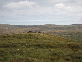

More summit photos
On a good day there are nice views across the river. Loch thom can be seen as well. I took these pictures next to the actual trig marker. It's an ugly wreck of a thing, a few mangled blocks of concrete with a rusty iron post leaning out the jumble. I didn't publish a photo of it. No wonder Craig and myself overlooked it last time we came up here. At least the mystery was solved.

The creuch ruins
The view towards lochwinnoch. It's a long way but I walked there last year with my brother and cousin and we did an overnighter at the old mine. My brother Craig came up with me last time in the middle of winter. You couldn't see zip. We also couldnt see the trig point marker either because the visibility was so bad in the hill fog. It began snowing too. The town got snowed in good style that night. It was nice to get a chance to look around for a change. 

Inverkip from creuch hill
You can just see the power station stack in the distance. The stones here are the remains of sheepfolds and shelters I think. 

View from the summit
Views towards paisley and glasgow from creuch hill. The views were good but not as impressive as some others because it is very barren up here and you are quite far back from the firth. It's pretty featureless moorland for miles around. Easy to get lost and it can be a miserable place in bad weather. The cloud just hangs on like grim death. The next stop east of here is lochwinnoch. A good four hours walk away. The disused barytes mine makes an unusual stop over if you fancy it.

Approach to the summit
The final approach to the south summit of creuch hill. There is no path to follow, so the going is pretty rough underfoot. Parts are marshy and the ground is uneven. There are also a few drainage channels cut into the peat as well and these are often hidden by the heather stumps or reeds. Just watch where you place your feet.

Fearless hound
Dougs shows scant care for his personal safety and well being as he plays at the edge of a raging waterfall. Hairy nutcase. Oi!! Nutter!!

Wednesday, 8 August 2007

The bridge
We walked on past the bridge up the old largs road before turning left onto the moor for the summit.

Creuch hill walk
Took Dougs (my dog) up to creuch hill today. Creuch hill is the highest hill in Greenock as far as I'm aware. We walked up to loch thom via whinhill then up the old largs road. The picture shows loch thom. This loch provides inverclyde with its drinking water. The water level is very low just now. The lowest I have seen it in ten years or so.

Back on terra firma
It was all over too fast. I have no idea what the helicopter engineer is doing in the background. We left the heli-pad and took a tour of the air museum including the tour of one of the retired concordes. It niffed of oxters and Bee Ohh inside. Disappointing...I think I would be a bit hacked off if I shelled out six grand plus for a one way ticket to find that the air crew were scrimping a bit on the scooshes of air freshener. After that we baled (haw haw .. air theme u see :-) ..) into the city centre for a pub crawl with cocktails. We ended up in a place called 'fishers in the city'. I would absolutely recommend it. Lovely food and the staff were super friendly and hyper efficient. We had the works including champagne and oysters..A great night to round off a great day.

Portobello beach
We also got a peek of portobello beach from the air. Next day we drove through it and found it to be foosty, drab and lacking. Don't go there. It looks better from the sky, which is, to be fair, a long way off. It's for the best.


In the helicopter
Neither of us needed to reach for the sick bags. Once you were up to speed it was surprisingly smooth. I expected it to be a bit more bumpy than it was. We did a scout round the city at around 12,000 ft. The weather was perfect despite the dodgy forecast.

WE ARE GONNA CRASH!!
The pilot introduced himself as 'Henry'. When things went quiet for a couple of mins I got a bit more concerned for Henry's well being. I realised that with the pilot sitting away from you pretty much motionless and mute, their eyes could be fixed and dilated yet you would have no clue that your pilot had expired and become a stiff some time ago. Cue the scenes from airplane :-)

Helicopter trip
As a break from the outdoor blog I thought I would do a wee trip journal to provide a tangential slant to my site. Hope you don't mind :-) Diane booked a helicopter trip over Edinburgh for my birthday way back in June so we decided to head out to auld reekie and make a proper weekend of it. We had a total blast. It was nail biting stuff though on the day of the heli trip because we very nearly missed it. An accident on the A1 and a missed turn off almost cost us the flight but people upstairs were smiling on us in more ways than one and we just made it with seconds to spare!!

Tuesday, 31 July 2007
Heading down
You can see a good portion of the town from here too. Inverclyde hospital stands out a mile as a big brown building. I can also see my old school and house as well as braeside where my friend used to live. Nat semis factory plant is on the left of the hill too. When you do decide to retreat back down, head for the left hand side of the grey stones which mark out the embankment wall near the fence and stream. It's easy to lose the return trail in snow or fog. Keep the dry stane dyke on your right as you descend and you should be fine. After that retrace your steps on the obvious tracks you walked up on to the summit. All the pics for Dunrod hill were taken today on a new camera but they seemed to turn out ok. The sky was looking a bit ominous and grey to the west which probably means a change for the worse tonight or tomorrow.. We shall see. Thanks for looking in.

Dougs at summit
Dougs sits at the exact spot where I popped the question as if to acknowledge its significance.


The summit at last!!
Congratulate yourself as you arrive at the summit marker. It's not a mountain, nor a munro. It hardly grazes 1000ft. It's a moorland peak at a push, but it's well worth a visit and you will be lucky if you see another soul en route. The views north towards argyll and its mountains are spectacular on a clear day in summer and even better in snowy winter. Look west and left down the firth of clyde to see ailsa craig if you are lucky. On a dismal day you wont even see your own hands in front of you :-) I have been up here in both rain and shine. If you have any snashters in your pocket then you can take them out and devour them now whilst you enjoy the views. Alternatively you could take out the diamond ring thats been burning a hole in your pocket for the last 2 hours, get down on bended knee and propose to the girl thats walked up with you on a day as sunny as this...hey..I did it myself and got the answer I wanted :-) 

Summit push
The underfoot conditions will be a bit more mushy now as you walk to the summit along a trampled grass track. In winter when the track is covered by snow you can reassure yourself by taking a compass bearing if you haven't been up here before and you want to make sure you dont't wander off the trail. You will lose sight of the summit marker for a bit as you approach it. Don't worry. You are on the right track. You can just see it as the darker tinged grass in the middle. The path will steepen up in the last 50 metres or so before the summit. A sure sign that you are almost there. You can see Dougs going mad in the right hand side of the picture. For some reason he goes bananas round here and wants to jump up on you and play? I haven't figured out why.

Stream fence and wall
The track comes to an end at this point. Cross the stream that flows out from the now drained and disused reservoir on the left. The stream lies directly in front of you. Walk up the embankment then cross the fence then the dry stane dyke wall right next to it. Walk to the end of the embankment then turn left to face the trig point obelisk which stands guard at the summit of Dunrod hill. You are nearly there!! You can just see it as the highest point mid shot. Word of warning here. If it's warm and damp with little wind then the midges can be nuisance at dusk. More likely to be a problem if you camp up here overnight. They are a special strain of midge known as the John Smeaton midge beause "they just set aboot ye". Without repellant or similar you will soon be "banjoed".

Left again
The trail splits once more. Keep left once again. Some nice views across the river should greet you once you get to this point. The right fork in this road takes you down to the cut waterway path and can be used as an alternative walk on a different day. You can descend by this route as well if you fancy a longer outing and you return to the watermans cottage via the cut path.

Turn left
Veer left after the tower and continue along the well defined track. The track dips down now and you weave your way round the right hand side of the hill. It would be difficult to get lost up here even in poor visibility because the tracks are so wide and well defined. You could easily take a mountain bike up here if you fancied it.

Thistles
Or how about this specimen eh? A fine example of a scottish thistle if ever there was one. They are there and you will find them if you look carefully enough.

Heather
If you look closely you will see bees pollinating the flowers among the heather up here in the summer.

Subscribe to:
Comments (Atom)